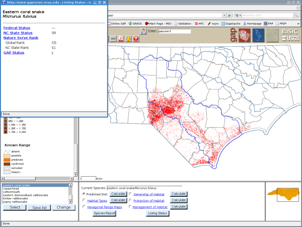
When a species is selected it will appear in the current species text area, and a predicted distribution map will appear.

To change to display name click the change button, and then the display type.

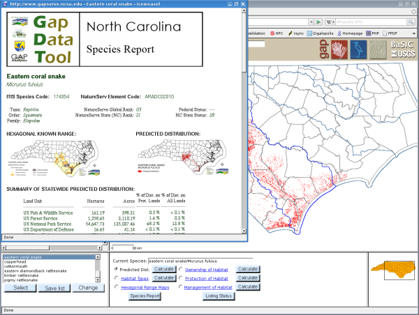
Creating maps or reports for species habitat, ownership, protection or management requires GRASS calculations, and can take several minutes for large AOI. However, after a map is calculated the user can pan and zoom on that map the same as an ordinary map. In the example, the map shows the habitat where the coral snake is predicted, and also a GRASS report of the same.